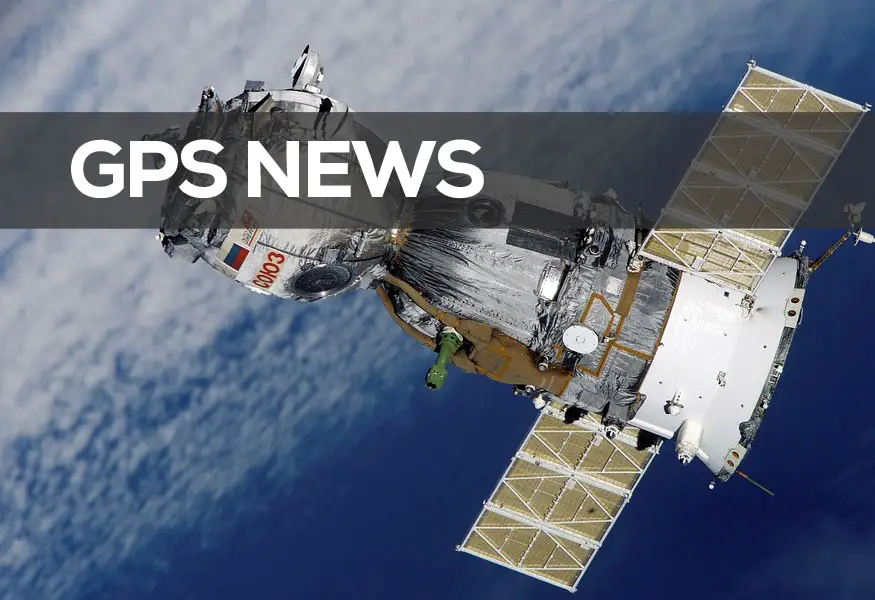
Man has always wanted to know where he is at all times. It’s part of our quest for adventure and discovery, and this has not changed since the beginning of time. The advent of sea-based adventures and exploration brought this to the fore with sea farers needing to know where they were and how to get back home again. They used to do this by following the coast lines, but of course this method was fundamentally flawed once they got out into the open sea. Because of this they then started to use the position of the sun, moon, and stars to plot their route via pre-prepared maps and charts. Read on for a short history of GPS systems including the major events that helped to shape GPS navigation as we know it today.
The Compass and Sextant for Sea-Based Navigation
The first major development in the history of GPS navigation which could be seen as the fore father of GPS was the advent of the compass and sextant. Because the compass needle always points in a northwards position it was possible for sea farers to know where they were and in which direction there boat or ship was heading.
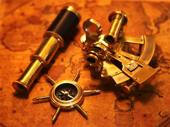
Coupled with the sextant they could measure angles of the stars, moon, and sun in relation to the horizon using small mirrors – but the early sextant devices were again flawed as they were only accurate when being able to measure latitude. Sea farers and explorers were still unable to calculate longitude and so the quest for more accurate navigation continued. This could be considered early GPS navigation systems.
Chronometer Navigation in 1761
Moving into the 17th Century, a group of scientists joined forces in England and called themselves the Board of Longitude. They said that they would pay a handsome fee to anybody that was able to calculate the longitude of a sea vessel to within an accuracy of 30 nautical miles. A clever guy called John Harrison stepped up to the challenge in 1761 with his invention of the chronometer timepiece.
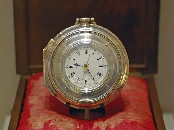
The reason this was so well received was because it only ever lost 1 second a day, and when combined with a sextant, the chronometer was able to let explorers and adventurers figure out what their latitude was… and now more importantly, also longitude. The World didn’t know it at the time, but this was an early development in the history of GPS systems and set us on the way to changing navigation as we know it today.
20th Century Radio-Based Navigation
These methods of navigation were used for a couple of hundred years until the advent of the early 20th Century. Technological advances now meant that radio could be used to aid navigation – with the most famous use of radio-based navigation occurring in the Second World War. It was possible for planes and ships to use this technology via radio navigation systems based on the ground.
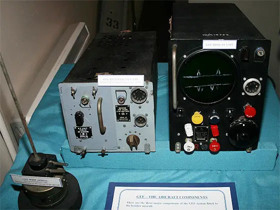
Despite this system being a huge advancement it was still not perfect because it used ground generated radio waves which need to make a choice between a high-frequency radio system that was inaccurate and does not cover large areas, versus low-frequency which had broader coverage but was also not accurate.
Tracking Ground Positions Using the Sputnik Satellite in 1957
Russia and the old Soviet Union made the next steps towards accurate navigation when they launched the first ever satellite into space. The Sputnik system was launched in 1957 and used “artificial stars” to help plot its course. Because of this it was possible to calculate the orbit of the satellite due to the signal from Sputnik increasing as approached, and the signal decreasing as it left.
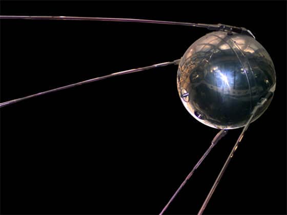
This confirmed the scientific assumption that a satellite’s position could be tracked from the Earth and was one of the first true technological steps in being able to calculate an object’s ground position using radio signals from a satellite that was orbiting the planet.
Tracking Submarines Using the Transit System in the 1960s
True satellite navigation was now a reality and the United States Navy started to experiment more in this field of study. There were a number of initiatives that were kicked off in the 1960s which included the Transit System. This was designed in order for military use as it helped to track submarines that were carrying Polaris nuclear missiles during the threat of the Cold War.
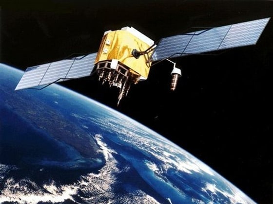
The Transit System used six satellites that orbited the Earth circularly in polar orbits. The US Navy were able to measure the Doppler shift of the radio signals and thus let the submarines be located by position in a timeframe of just fifteen minutes.
Global Positioning System Launched in 1978
This advancement in the technology led on to the Global Positioning System (or GPS) as we know it. Again, it was designed and built for military use and was developed by the United States Department of Defense. Originally it was going to be called the Navstar Global Positioning System and was first conceived at a Pentagon meeting in 1973. The US military wanted a navigation system that was error proof and could provide accurate location positioning and directions during war and peace time.
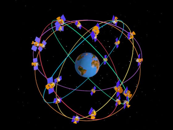
By 1978 they had launched the first GPS satellites into orbit and by the 1990s the system was using 24 satellites to accurately provide GPS for a number of applications and was then made available to be used by public companies. The Global Positioning System history was now ready to make the first steps into being used by the public for things such as in-car navigation and exploration methods.
GPS Used for Public Applications by the 1990s
Nowadays of course, GPS navigation is a technology that has been widely adopted for use in consumer electronics with companies such as Garmin and TomTom leading the field for in-car portable navigation devices. GPS is also being used in many other different fields including things as diverse as early warning systems for Tsunamis. The history of GPS navigation still has some way to go, and it’s fair to say that it’s impossible to predict where it will take us next.
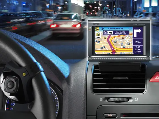
Recent news has highlighted people now looking to take indoor location positioning as the next level, and even attempts to create new and better alternatives to GPS navigation. Whatever happens next, GPS navigation is here to stay and will continue to be a huge part of our lives for years to come.
Updates to the History of GPS Navigation
We will update this History of GPS Navigation page as soon as any new developments in the technology occur so please bookmark the page for future reference or share it on your social networks using the buttons you see on this page. If you wish to reference any of the material on our website then we would appreciate that you credit us with a link back to the History of GPS Navigation page on the GPS Bites website.

