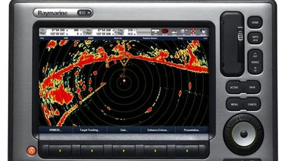
When it comes to sailing, almost everyone knows what the radar is. However, very few know how the radar is used. Radars are those devices that are used to measure the time as well as bearing of the nearby objects. After the analyses of these factors, the echoes or targets are figured out and the painted on the screen. Actually, this gives you a bird’s eye view of the local map. It does not restrict you to large objects only. This includes weather systems, landmasses and other subtle movements. An easy way to remember this is that the yacht radar helps you see what is around you.
How to Navigate with Yacht Radar
Do you know to know how to navigate with your yacht radar? While sailing a boat, sometimes, you have to cope with strong wind and the current. Such factors may change the direction of your boat. In such a situation, if you do not have a GPS system or the radar mounted on your boat, then you may soon get lost in the sea before you know it. To know your location, you may make use of a Variable Range Marker in order to marking a range and bearing on specific targets. Actually, the VRM is a small mark you can place over any of the objects visible on the radar.

Once you have finished marking it, the radar will show you the number of nautical miles between a certain object and you boat. You may also use a feature called echo trail to find out where a certain object used to be. You can also adjust the trail time. The radar can also be used to figure out range. Objects within the range reflect the pulse of radar and can be tracked from the boat to exact number of nautical miles.
Lollipop Display Shows Important Information
The majority of radars shows a “lollipop” display that gives you important information, such as the display range, land mass, yacht position, selected waypoint, the yacht’s batch, direction of the yacht, waypoint bearing and fixed range rings. You will take some time to understand and memorize what different blips on the display mean. It assists you in using the boat radar when the weather is normal.
You should plot and track objects manually if you have no boat radar. You can do this by taking a visual bearing on another yacht and then checking it later in order to find out if its location has changed. In this way, you can plot the position of a certain object. As far as the positioning of the boat radar is concerned, it is important to know that you should take a stance of defensive avoidance. You should consider every blip on the screen as a threat unless the blip is clearly visible. You should monitor the position of the blip until it goes out of your way.
The radar is an important tool you should take with you. You can use it to get detailed information about weather and different objects around you in the water. This is how you can navigate with your boat radar.

