In this week’s interview we managed to speak with Michael W. Dobson Ph.D who runs the TeleMapics organization. TeleMapics provides independent advice on mapping, geospatial technology and solutions for applications that use geographic information. He truly knows the GPS industry inside and out. In this in-depth interview he gives us his views on the challenges that are facing Apple’s entry into the portable navigation market, mistakes made by TomTom with their acquisition of Tele Atlas, and how companies like Garmin should be looking to adapt their businesses due to the changing GPS marketplace.
1. Hello Michael, as the President of TeleMapics could you give us a brief overview of what the company’s main aims, goals, and services are and how the business runs so our readers can get a better insight into what you do?
 TeleMapics is a consultancy focused on providing our clients advice on issues related to the use of Geographical Information in their products and services, as well as for strategic planning. Our clients are from diverse sectors of the economy, ranging from commercial businesses to government agencies. Although our offices are in California, a considerable portion of our work is internationally based.
Much of our work is focused on Location-based Services and usually requires a specialization in mapping, navigation, geospatial technology and local search. We, also, provide expert services for contractual and intellectual property issues, including due diligence and valuations related to mergers and acquisitions.
TeleMapics normally operates as a one person operation, as I find this singular focus to be very effective in meeting customer objectives in a short period of time. However, based on customer needs, I pair with associates who have specific skills that might be required for more extensive assignments.
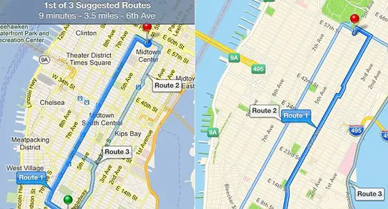
2. We recently read your excellent blog post in which you discussed Apple’s recent partnership announcement with TomTom. In the blog you say that you believe Apple is going to face many challenges in providing quality mapping solutions to its customers and that the TomTom relationship won’t necessarily prosper. If you were in a decision making position at Apple, what strategy would you have taken instead to make sure that the company establishes itself as the number one in portable navigation for consumers?
I certainly do not know the specific decisions that led Apple to decide to enter the portable navigation market or the potential acquisitions that they might have considered before they committed to their present course of action. From my perspective, the acquisitions that Apple did conclude, were not significant and did not position them adequately for the challenge they are facing.
It is commonly the case today that mapping databases and navigation are considered the realm of software engineers. The usual approach is “take this data from here, do a spatial transform, slice it, project it, conflate it with this data here, add some satellite imagery, conflate again, add a routing algorithm and voila, you have a perfectly functioning navigation system.” Well, you may have a perfectly functioning planar graph, but you will not have a perfectly functioning navigation system.
It appears to me that Apple may not have the experience to understand, or perhaps appreciate, the issues related to spatial data quality and may not have noticed that map data, like some agricultural produce, generally has a short shelf-life. In my blog on Apple, I asked the question, “…do these people known anything about maps?” The question applied both to Apple, as well as the reviewers who were already celebrating the company’s accomplishments in the world of mapping.

Let’s ask a set of questions that might be helpful to Apple. Does Apple have a Chief Cartographer? Does Apple have a Cartographic Advisory Board? Who is helping them address the myriad problems they will experience with data quality and data integration? If I were in a position of influence at Apple, I would have gathered the best and the brightest stars to help the company build the best application ever and provision it with the best map and attribute data that could be produced.
While I am not saying that Apple has failed to gather some very bright people, I am less certain that they have assembled the topical advisors that could help them make a difference in mapping and navigation and this is one of the first things I would have arranged. However, maybe they have done this and maybe their code of secrecy is so strong that I have not heard about it, although I doubt it.
As a final note, for those of you not familiar with my background, I am now working in my third career and considering a transition to a fourth in an area of interest to me, but unrelated to mapping or GIS. Put simply, I am not looking for a job. Perhaps more to the point, I have already been a chief cartographer and I consider it a position that a professional might want to hold … once.
3. You also stated that you don’t believe that Tele Atlas has really progressed since being acquired by TomTom in 2008. Are you able to expand upon this point and give us a little bit more insight to how you believe the Tele Atlas maps and data could be improved?
Based only on my personal knowledge of the market it is my belief that Tele Atlas is, once again, for sale. Why is this so?
The practical fact of the acquisition of Tele Atlas by TomTom is that TomTom grossly overpaid for Tele Atlas. In part, they can thank Garmin who made a laughable run at Tele Atlas while they were negotiating a significant contract with NAVTEQ. Not only did Garmin sucker NAVTEQ who was being sticky about its pricing and get a great long-term deal, but they nearly doubled the price that TomTom paid to Tele Atlas by threatening the acquisition. At the same time, TomTom’s shares and valuation were at an all-time high, as the PND market was booming, what’s a few million more Euros?

Unfortunately, PNDs fell out of vogue to cell-phone-based routing, which was the next big thing. TomTom was caught flat-footed by this change and at the time it carried an enormous debt burden due to the acquisition of Tele Atlas. One of the results of the technology transition was the number of people registering map corrections using TomTom’s popular and well-engineered MapShare application began to decline. TomTom had thought that it could beat the cost out of the Tele Atlas map compilation expense (which was quite large and the reason why the company was relatively unprofitable throughout its history) by switching to MapShare-assisted compilation.
Unfortunately, the plan did not quite work out and the promise that MapShare might have brought to Tele Atlas was never realized. It is my opinion that the promise was not realized because TomTom, suffering from decreased sales and reduced profits, could not afford to spend enough money on MapShare to realize the promise that it once held.
I do not see TomTom being able to afford the type of technical innovations that are needed to improve the quality of its spatial database. In addition, it is my opinion that TomTom has downsized Tele Atlas to the point that its leading scientists, critical software engineers, and spatial database architects are no longer with the company.
How could TomTom have not done everything in their power to retain the services of Don Cooke and the other luminaries no longer working for the firm? Could the Tele Atlas data be improved? Of course. Do they have the money? No.
4. How do you think that companies such as Garmin and TomTom need to change their business models over the next couple of years due to the increasing adoption of smartphone navigation? What are the challenges they face and do they have a future in portable navigation still?
Garmin is highly diversified across its product lines. It has a significant interest in GPS devices that are used for marine navigation, outdoor fitness, mobile, and aviation markets in addition to the automotive market. However, even this diversification will not provide enough growth to compensate for the loss of the PND market (due to customer preference for cellular technology.
Garmin could survive as a profitable, but smaller company. I suspect, however, that they might divest one or more of their smaller business before selling the remaining entity.
TomTom does not have the financial cushion of a Garmin and has not diversified enough to remedy their current financial problems. Make no mistake, they are attempting to work with OEMs to get their navigation units in more cars and are having some modest success doing so. In addition, they are attempting to monetize their traffic business, as well as forward integrating into logistics. However, their best hope is to sell the company. Unfortunately, the management seems to have an unreasonable estimate of the company’s worth and a handy corporate “poison-pill” will preclude action by any entity that might want to attempt an unfriendly takeover.
Whether TomTom survives and prospers depends on whether its owners are willing to accept that the glory days are over and sell while they still have something to sell.
5. What are your predictions for GPS technology over the next 24 months? Currently there is a lot of noise surrounding indoor location positioning as an example.
I’d make a slight distinction here between GNSS of which GPS is one example and other location technologies (including those focused on indoor location).
For GNSS, the emergence of systems in Europe, Russia and China that are complimentary with and potentially competitive to GPS will keep the market interesting for a variety of reasons.
I am less sanguine about indoor positioning market, as I am not sure that there is a significant market for the solution. Yes, I can make the case for many applications that would use the technology, especially in the area of public safety or logistics. However, it seems to me that the people who want to use this technology are the people who want to know where things are or where you are located. Based on my experience when I am indoors, I pretty much know where I am (this is starting to sound like Buckaroo Banzai – “wherever I go, there I am).”

One other issue of importance here is that GPS, LBS, navigation, mapping and various aspects of this ecosystem are being commoditized. I am not sure these markets will remain interesting for much longer as GPS, LBS, GIS, mapping and navigation are being subsumed by other markets and rapidly becoming plumbing.
I expect that in a few years, map database, mapping, routing, navigation, and other similar functionalities will be provided as infrastructure from some organization smart enough to put it all in a cloud and rent it out to companies that want to provide products based on these services. After all, why should everyone invent routing and mapping anew, every time someone wants a “new” version of an “old” service? These things are sort of like oxygen, good to have, but hard to differentiate unless they are really bad – like the air quality in Los Angeles.
However, until that happens, there will be lots of mistakes that will keep good consultants in business. Hmmm. Maybe I should reconsider that fourth career?
6. Is there any particular project that TeleMapics has completed over the last couple of years that you are particularly proud which you can give us details on including the problem, solution, and benefits to the work you completed?
It is one of the unfortunate aspects of my consulting practice that non-disclosure agreements usually limit my ability to speak in any detail about any of the engagements in which I participate. What I can reveal is anecdotal, but nevertheless informative.
After being approached by a client who had a significant interest in entering a new market, I conducted an analysis of whether or not they should enter a specific segment of the navigable map database market. Based on my analysis of the company, its capabilities and resources, as well as the target market, I concluded that it would be imprudent of them to attempt to enter the market at that time. My executive briefing on the topic was not met with a positive response. Numerous executives indicated that I did not understand their corporate capabilities and ability to field and successfully complete complex, and expensive products. As I left the briefing room, I heard the chairman of the company mutter, “Well that was bowel of cold water.” I knew my advice was sound, but I shared the client’s disappointment.
Within the last year, I received a note from the same chairman. His note indicated that he was belatedly writing to thank me for my recommendation and concluded that the project would have bankrupted the company, while noting that the market had declined exactly as predicted during the briefing.
It is sometimes hard to deliver the appropriate message to a client, but my belief is that a good consultant will give the client their best advice, whether it is well received or not. All consultants should remember that you client is paying you to tell them what you know, not to tell them what they know. Successfully managing that tension in a manner that produces positive results is one of the most important challenges for all consultants.
7. Do you have any exciting projects coming up that you can share with us, or any forthcoming news and developments that would be relevant to the GPS industry and customers that read our website?
During the last three years my colleague Stephen Guptill and I have developed a keen understanding of the issue involved in addresses and addressing related to series of projects we have been researching for the Geography Division of the Bureau of the Census in the United States to help improve the geographic infrastructure that supports the Bureau. Our leading project involves their Master Address File, which contains 275 million addresses representing a smaller number of housing units, living quarters and non-residential units.
We think that the Geography Division is well on their way to being able to provide highly accurate address information and mapping for the support of the 2020 U.S. Decennial Census. The surveys of the Census Bureau are one of the most important sources of demographic data available in the United States and we believe that the data for 2020 Decennial Census and the American Community Census, which is conducted yearly, will reflect a higher level of comprehensiveness, accuracy and coverage in terms of map and address data than ever before.
GPS Bites: Thanks to Mike from TeleMapics for this superb interview. If you would like to know more about Mike and his company then please visit www.telemapics.com to learn more. If you have any questions you would like to ask Mike then please use the Facebook comments box below.

