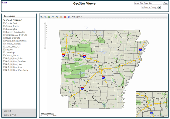
Shelby Johnson works as the State Geographic Information Officer of Arkansas and has nearly 20 years of experience in Geographic Information Systems (GIS). The Arkansas Geographic Information Office is responsible for providing administrative and technical support to the Arkansas Geographic Information Systems Board and run GeoStor (Arkansas’ geographic information system). We managed to interview Shelby so he could tell us more about his role AGIO including how they use GPS and innovative plans for the future.
1. Hello Shelby, and thanks for agreeing to be interviewed by GPS Bites. As the State Geographic Information Officer of Arkansas could you tell our readers what a typical working day involves?
Thank you. I’m always excited to share about our work in the Arkansas Geographic Information Office. Parts of my day are somewhat mundane because a lot of role my as Director of the agency involves administrative tasks associated with the bureaucracy of state government. Putting my administrative work aside, a typical day always involves communicating constituents. The majority of those interactions are from someone looking for data. I really enjoy it when we already have that data published on our state GIS platform and can help them. Despite having a well established platform there are days when someone is trying to find something that we don’t have.

On other days I spend a good deal of time attending meetings. These involve some aspect of coordination for GIS or where GIS could play a strategic role in solving a problem. I’m also lucky to attend a number of legislative hearings where I can listen and learn about policy issues and the decision making process in the legislature. I do this to stay up to date on potential policy issues where GIS could step in and help.
 I also interact with my Policy Advisor in Governor Beebe’s Office on a regular basis. These are usually situations where the Governor’s Office needs a map to illustrate an issue or to locate a resource and then understand how that relates to the various administrative boundaries in that area. For example what School District, or what Fire District, or House District or Senate, and so on.
Governor Beebe really has been a champion for our work and his office uses our capability regularly. It’s fun for me when we are able to help at the highest level here in the state. I feel like I’m one of those folks who fell into a job they really love and I can see myself working here for as long as I can.
2. How important is GPS technology to the programs that the Arkansas Geographic Information Office runs, and what is the best example of how you have used it in your organization?
It’s blinking blue dot important. In this age where so many constituents are carrying a smart mobile device with GPS services enabled it is incumbent on my agency to ensure both public and private users have the best data available. When I have the chance to speak to groups here in the state I try to ask the audience the question, “How many times has your GPS been wrong?” Then I get the opportunity to explain that the GPS isn’t wrong it’s the base map underneath the blinking blue dot that’s wrong. I go on to explain that our public safety community works very hard every day to ensure the base map in their jurisdictions is accurate and up to date. I then explain the role our agency plays in bringing their data together so that it can be published, shared and used.
We use GPS the most in training for field verification. We go out to our partners at the local level and teach them how to use GIS and GPS software in their vehicle to field verify the road centerline and address point data. Having GPS for field verification is critical for public safety.
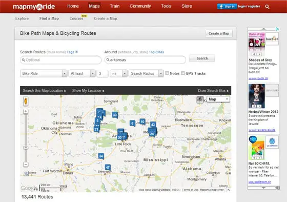
Consumers have faith that public safety response can find them. They see that blinking blue dot as “Me, that’s where I’m at.” And, so we need to do our best to assist our partners in public safety with maintaining their data. Of course GPS brings us all of the other conveniences such as routing, recreation, and even workout aids like MapMyRide or Strava. So in my view, the saturation of GPS in the consumer market has forced everyone to coordinate on improving our base data for the public good and ultimately that makes my job easier.

3. What are the main challenges that your AGIO faces when creating digital mapping data or cadastral mapping program – from both a technical and resource perspective?
You might be surprised to know that we actually do not create a lot of data here in the office. We like to say that we spend most of our time teaching people to fish instead of fishing for them. Our partners like other state agencies, the cities and counties do most of the local data creation and so we spend time with them assisting on technical issues. There are still times when the financial resources just are not available for local data development. This frustrates me the most but when times are tight local elected officials have to make tough choices and GIS development can be low on the priority list.
On the technical side our main challenge isn’t that technical, it’s more of a human resource issue. Our local data creators in the cities and counties have a pretty high rate of attrition. So it seems like any given week we are training or assisting a new person with technical issues related to the GIS software. The previous person we trained left for a better opportunity. I would guess this is a constant challenge for any large organization.
4. Recently the US Senator for New York called for an investigation into GPS navigation being the cause of commercial trucks crashing into low bridges. Do you have any similar issues in Arkansas due to poor truck-relevant mapping information on GPS devices?
Yes, in fact we do. As a rural state we have a lot of unpaved roads and unless truckers have systems that are commercial truck specific they can have drivers taking a road that isn’t suited for trucks. Last year we had a semi-truck over turn on an unpaved mountain road. The refrigerated trailer ended up more than one hundred feet down a hill side and 80,000 pounds of frozen food was lost. This cost the trucking company, their client, and the destination customer time and money. Not to mention the insurance loss. It also likely caused that driver their job because they took an unpaved road that clearly was not suited for a large truck.

I attribute that situation to the fact that commercial data vendors may have used public data to render their roads based on functional class like arterial or minor collector. I suspect that county had the road classed as an arterial road because it connects part of the county. So cartographically it would have rendered as a minor road which would lead someone to route that way because it was the most direct route. Cartographically a user would assume it was paved. If that truck had been equipped with a truck routing system that driver would have never been on that road. After this happened we alerted our contacts in the commercial data market this road should be taken out of their trucking routes.
5. We notice from your Twitter profile that you are a keen outdoors man and sports enthusiast. Do you use GPS at all when taking time out in the great outdoors such as handhelds or cycling computers?
I use MapMyRide on my smart phone to record my road bike rides and as mobile coverage improves I find myself using my phone for other GPS related services like tracking where I’m at when I’m hiking. When I’m kayaking I leave electronics at home except for my waterproof camera. Even though I’ve been in the geospatial business for nearly 20 years I still get excited about seeing myself as a blinking blue dot.
6. What new plans and initiatives do the Arkansas GIS team have coming up in the near future that you can tell our readers about?
We are very excited right now about creating mobile applications. Just little simple one layer overlays onto existing base map data that can be used on smart mobile phones. I see so many big hits we can have on those four inch screens. We have a strong focus on trying to get all of our counties to finish their tax parcel GIS data. In fact we have 20 plus counties under contract to get that data created. When they are done it will change how they go about their daily business.
The other exciting program we have in the works is the completion of a statewide master address database. Right now we have 40 plus counties published with well over a million records that represent the authoritative physical address assigned by the local authority.
The most exciting thing we have ahead of us is that our state’s decision making and analysis is bound to improve as we bring better more improved data online. We’ve spent a decade working toward getting this public data published and now we’ll be able to watch it be used and re-used in desktop and mobile applications that support decision making and that’s exciting.
More Information: If you would like to find out more about the Arkansas Geographic Information Office and their work then please visit their official website on www.gis.state.ar.us. You can also follow Shelby Johnson on Twitter.

